The remote route to Kilimanjaro
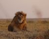
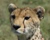
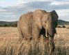
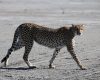
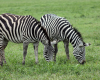
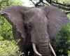
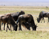
A relatively new route, the Lemosho Route was introduced as an alternative to the Shira Route, starting on the Western side of Mount Kilimanjaro at the Londorossi Gate. The longest and most remote route to Kilimanjaro, Lemosho passes through beautiful forests and moorlands, crossing the Shira Plateau to meet up with the Machame Route. Climbers are offered captivating scenic vistas, pristine wildlife, excellent acclimatization opportunities, and the lowest traffic of other climbers.
Meals are prepared by your cook, while porters pitch up your tent and often time arrive at the camp before you to prepare it. Obviously, if you are experiencing severe AMS (Acute Mountain Sickness) symptoms you should descend immediately.
Itinerary
DAY 1: Londorossi Park Gate to Mti Kubwa Campsite
After breakfast, you will take a drive to Londorossi Park Gate. Half an hour is spent on registration and obtaining of the permit for the climb, and afterward, continue with the hike through the Lemosho Glades at 2,100 m (6,825 ft).
The 3-hour hike will follow the forest trail to Mti Kubwa (Big Tree) campsite for dinner and overnight stay.
Elevation: 2,750 m (9,100 ft)
Hiking Distance: 7 Km
Hiking Time: 3 – 4 Hrs
DAY 2: Mti Kubwa to Shira Camp 1
Today’s trail gets steep and crosses several streams in the giant heather zone. You will cross the Shira Ridge and descend to Shira 1 Camp, situated on the southern edge of Shira Plateau. The campsite offers a fantastic view of Mount Kilimanjaro, and by climbing the little slope up against the campsite, you can get a view of the whole plateau. You will camp for dinner and overnight by a stream.
Elevation: 3,505 m (11,500 ft)
Hiking Distance: 7 Km
Hiking Time: 4 – 5 Hrs
DAY 3: Shira Camp 1 to Shira Camp 2
A gentle walk across the plateau leads to Shira Hut camp, on moorland meadows situated by a stream. The day offers excellent opportunity to acclimatize by taking a variety of walks across the plateau floor, with dinner and overnight at the camp.
Elevation: 3,840 m (12,500 ft)
Hiking Distance: 10 Km
Hiking Time: 3 – 4 Hrs
DAY 4: Shira Camp 2 to Barranco Campsite
The day starts by following a rocky path that heads east towards the Lava Tower; a 3,000 ft tall volcanic rock formation for acclimatization at 4,630 m (15,190 ft). Time spent at higher altitudes is very beneficial for acclimatization, and shortly beyond this point, you will descend to Barranco campsite for dinner and overnight stay.
Although you end the day at a closer elevation as when you started, the act of ascending and sleeping at a lower elevation is vital for acclimatization and will help your body prepare for summit day adaptation.
Elevation: 3,950 m (13,044 ft)
Hiking Distance: 11 Km
Hiking Time: 5 – 6 Hrs
DAY 5: Barranco Camp to Karanga Camp
The day’s hike involves the climbing of the Barranco Wall that offers views of an amazing landscape. You will descend into a ravine at the base of the wall, followed by a scramble that may involve the use of all four limbs to the top at 4,200 m. From there you will transverse over screens and ridges to Karanga Valley campsite beneath the icefalls of the Southern Glaciers for dinner and overnight stay.
Elevation: 3,937 m (13,106 ft)
Hiking Distance: 5 Km
Hiking Time: 2 – 3 Hrs
DAY 6: Karanga Camp to Barafu Camp
The hike ascends a ridge to a campsite by the Barafu Hut; an airy location with little vegetation. You will spend the afternoon enjoying the scenery and resting the muscles while making sure you keep warm and hydrated. You will have an early dinner followed by an early sleep in preparation for the midnight summit push.
Elevation: 4,600 m (15,331 ft)
Hiking Distance: 4 Km
Hiking Time: 2 – 3 Hrs
DAY 7: Barafu Camp to Uhuru Peak
Just after midnight, you start the ascent leading to Stella Point at 5,739 m. You ascend in the darkness for several hours while taking frequent, but short breaks. At Stella Point, you will stop for a short period and be rewarded with the most magnificent sunrise across the Tanzanian landscape. From here a further 45 minutes leads to Uhuru Peak; the highest point in Africa.
Elevation: 5,895 m (19,341 ft)
Hiking Distance: 5 Km
Hiking Time: 6 – 7 Hrs
- Descent to Mweka Camp
Your time at Uhuru Peak will be brief before descending to Barafu Camp for rest and brunch, and afterward, continue down to Mweka Camp for dinner and overnight stay.
Elevation: 3,100 m (10,065 ft)
Hiking Distance: 12 Km
Hiking Time: 4 – 6 Hours
In total, your hiking distance will be 12 – 16 Hours, so it’s important to pace yourself and remain hydrated. Dinner and overnight stay will be at Mweka Camp.
DAY 8: Mweka Camp to Mweka Gate
This is by far the easiest day as you descend and the oxygen supply increases. You will reach Mweka Gate situated at 1,640 m (5,380 ft); receive your summit certificate and meet your driver for the transfer to your accommodations.
Hiking Distance: 10 Km
Hiking Time: 3 – 4 Hrs